When this simulation was created, Java was a hot new language and Java applets allowed fast
applications to run within your browser. Sadly, a decade or so later,
Java applet support was removed from browsers. It may still be possible for you to run this
simulation if you have a very old browser or install a plug-in. For most people, this is just
here for historical reference.
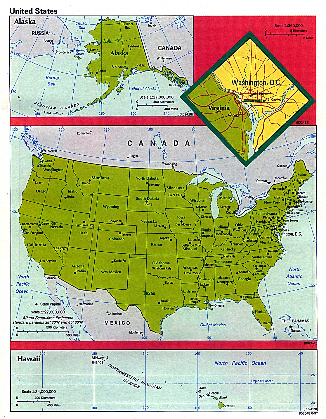
Select "us.jpg" from the drop down box at the middle right.
Wait a long time for it to download.
Scroll the map down until you see the scale for the continental U.S.
Select the "ruler" checkbox.
Drag the mouse from the beginning of the scale to the end (500 miles)
Click on the text box after "ruler", and enter "500"
Click on the "scale name" checkbox.
Click on the text box after "scale name" and enter "miles". (Technically, this particular text box is a placebo.)
Scroll the map until you see Ohio.
Click on the "move" checkbox.
Click the mouse about 1/3 of the way from Springfield IL toward Chicago.
Click on the "clear and trace" checkbox.
Trace the outline of Ohio (press the mouse button somewhere on the perimeter of Ohio and then move the mouse around the perimeter while holding the button down and be careful to finish at your starting point.)
Look at the value in the text box after "wheel reading." The number there should be about 40000.